
Senior Capstone Projects (2008-2009)
 Septic System Survey of Residents of Loughberry Lake
Elizabeth Amira Kennedy Streeter (2009)
Unlike government run sewage treatment plants, septic system care and maintenance are the responsibility of individual homeowners. Proper maintenance is essential to maintaining proper functioning and preventing water pollution. To better understand behavior and septic maintenance practices, I conducted a survey of the residents who lived closest to the lake and also own septic systems.
Full report is not available. Please contact Cathy Gibson for more information.
 Rethinking Wastewater Treatment: An Examination of the Saratoga Wastewater Treatment
Facility
Rethinking Wastewater Treatment: An Examination of the Saratoga Wastewater Treatment
Facility
Kathleen McConkey and Molly Nowak (2009)
Most people rarely think about where their water goes after they use it. We've taken a closer look at this important aspect of everyday life and environmental protection by examining the Saratoga wastewater treatment facility and putting it in context with other operations in New York State.
Full report is not available. Please contact Bob Turner for more information.
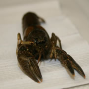 Concentration and Distribution of Copper in Crayfish in Loughberry Lake
Benjamin Alley (2009)
Copper sulfate is added to Loughberry Lake to control algae. I examined the geographic distribution of crayfish copper concentrations in Loughberry Lake and looked for evidence of accumulation within the crayfish. Crayfish from three locations on the lake were analyzed for copper to examine geographic distribution, and five crayfish of various sizes were examined from one location to examine accumulation.
Full report is not available. Please contact Cathy Gibson for more information.
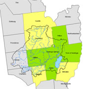
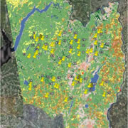 Changes to Saratoga Lake’s Hydrology after 20 Years of Development and Growth
Matthew Shrensel (2009)
I used satellite imagery to examine shifts in land use in Saratoga Lake Watershed over the past 20 years. I modeled hydrology for the watershed based on the land use from the imagery. Despite large changes in population, land use change is low, and associated hydrological shifts are minimal.
Full report is not available. Please contact Cathy Gibson for more information.
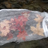 Breaking it down: The Influence of Relative Nitrogen and Phosphorus Availability
on Leaf Litter Decomposition and Macroinvertebrate Communities in Two Small Streams
within the Saratoga Lake Watershed
Breaking it down: The Influence of Relative Nitrogen and Phosphorus Availability
on Leaf Litter Decomposition and Macroinvertebrate Communities in Two Small Streams
within the Saratoga Lake Watershed
Alicea Cock-Esteb and Hannah Harris (2009)
When leaves fall into streams, they are incorporated into the food web through consumption by microorganisms and macroinvertebrates. Our study examined how the relative availability of nitrogen and phosphorous influenced the rates of leaf litter decomposition via macroinvertebrate communities and microbial respiration in two small, wooded streams in the Saratoga Lake Watershed. We found that a higher relative availability of nitrogen and phosphorous corresponds to higher decomposition rates although the macroinvertebrate community seems to be more influenced by other factors.
Full report is not available. Please contact Cathy Gibson for more information.
 Designing and Institutionalizing a Place-Based Watershed Curriculum in Ballston Spa
Hannah Phillips and Sarah Whateley (2009)
We designed place-based lesson plans to complement the in-class ecosystem unit for a fifth grade classroom in Ballston Spa, New York and to increase students’ awareness of place. Our interviews with local teachers and administrators identified challenges to implementing such programs. We also assessed the students’ prior environmental knowledge.
Full report is not available. Please contact Bob Turner for more information.
 Weather or Knot: The Impact of Natural and Anthropogenic Disturbances on Japanese
Knotweed
Weather or Knot: The Impact of Natural and Anthropogenic Disturbances on Japanese
Knotweed
Daniel von Allmen, Peter Leipzig-Scott, Erin Kenison (2009)
Japanese knotweed is an aggressive invader of riparian habitats. Our study investigates how natural and anthropogenic disturbances, including flooding, human land use and natural stream channel migration, affect the distribution of knotweed. These disturbances had differing effects on knotweed presence. A large percentage of plants were damaged over winter months, which may contribute to plant fragmentation and subsequent dispersal.
Full report is not available. Please contact Cathy Gibson for more information.
 Saratoga Lake Landowner Survey: Assessing Behaviors, Perceptions and Opinions
Andrew Clinard, Jennifer Hubert, and Bradford Nesbitt (2009)
Our survey of Saratoga Lake residents revealed that most respondents think water quality is acceptable and affects property values, but is threatened by invasive species. While opinions varied on who should maintain the lake, most opposed land use regulations. Future studies and public outreach should focus on these subjects.
Full report is not available. Please contact Bob Turner for more information.
 The Capacity for Smart Growth in the Saratoga Lake Watershed: A Study of the Local
Planning Process
The Capacity for Smart Growth in the Saratoga Lake Watershed: A Study of the Local
Planning Process
Rose Anderson-Gips and Amanda Peterson (2009)
Are municipalities in rapidly growing Saratoga County managing development to minimize environmental impact? We reviewed comprehensive plans and surveyed and interviewed planning board members in twelve municipalities within the watershed and found a strong commitment to most smart growth goals, though a limited interest in regional planning.
Full report is not available. Please contact Bob Turner for more information.
 The Uneven Implementation of the Saratoga Lake Watershed Management Plan: Priorities
and Perceptions of Municipalities within the Watershed
The Uneven Implementation of the Saratoga Lake Watershed Management Plan: Priorities
and Perceptions of Municipalities within the Watershed
Ryan Bailey and Lyndsay Strange (2009)
In 2002, a group of stakeholders created a Saratoga Lake Watershed Management Plan
to protect and improve the watershed's resources. Despite this, implementation of
the plan's recommendations has been very uneven throughout the watershed's municipalities.
Through interviews with local town officials, we identify and explain the factors
that affect the implementation of these programs.
Full report is not available. Please contact Bob Turner for more information.
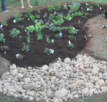 Current Stormwater Management in Saratoga Springs and the Challenges of Implementing
Low Impact Alternatives
Current Stormwater Management in Saratoga Springs and the Challenges of Implementing
Low Impact Alternatives
Allison Ruschp, Caitlin Frame, and Dani Rueter (2009)
We explored the feasibility of incorporating low impact design into Saratoga Springs stormwater management program. We interviewed developers, public works officials, planning board staff, city engineers, and state stormwater engineers to discover the challenges facing the implementation of low impact stormwater management. Saratoga Springs is close to meeting current federal standards but has no funding mechanisms for stormwater management; low impact design is being encouraged for new developments.
Full report is not available. Please contact Cathy Gibson for more information.
 The Influence of Beavers on Sediment Storage and Stream Turbidity in the Saratoga
Lake Watershed
The Influence of Beavers on Sediment Storage and Stream Turbidity in the Saratoga
Lake Watershed
Stephanie Abrams, Lindsay Bourgoine, and Alexandra Furman (2009)
This study examines the repopulation of beavers within the Saratoga Lake Watershed through pond density and how their ecosystem engineering has geomorphically impacted water bodies. The three beaver ponds investigated stored large quantities of sediment and the amount of suspended particles decreased downstream of the ponds. Therefore, increases in pond density result in changes in the way sediment is stored in the watershed.
Full report is not available. Please contact Cathy Gibson for more information.
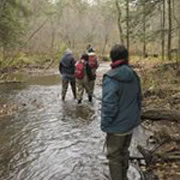
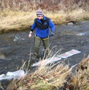
 Waterways: A Photographic Exploration of Human Presence in the Saratoga Lake Watershed
Andrew Plotsky (2009)
Waterways is a photo essay of people in the Saratoga Lake Watershed. Using the style of environmental portraiture, Waterways features fourteen human subjects from various backgrounds to represent a cross section of the diversity of the watershed. The project illuminates the complex and nested relationships that exist within a watershed.
Full report is not available. Please contact Bob Turner for more information.
Summer Collaborative Research (2009)
 Managing Drought in a Water-Rich Region
Ellen Agnew '11, Kelly McDonnell '12, and Kim Marsella, Environmental Studies Program
Coordinator and Lecturer
Saratoga Springs, NY, though water-rich, has had a long-standing politicized debate
over the future of its water supply. We analyzed the historical drought of record
in the mid-1960s, the city’s response to this drought, and how it has affected water
planning using archival data and interviews with local government officials and residents.
Significant results of the 1960s drought include a severe drawdown of the reservoir
and the implementation of Bog Meadow as a supplemental water source. While numerous
studies have advocated for an alternative source and long-term water management policy,
neither has been implemented to date. A combination of factors ranging from additional
supplementation, the passage of time since a severe shortage and local political dynamics
seem to hinder the adoption of proactive drought policy.
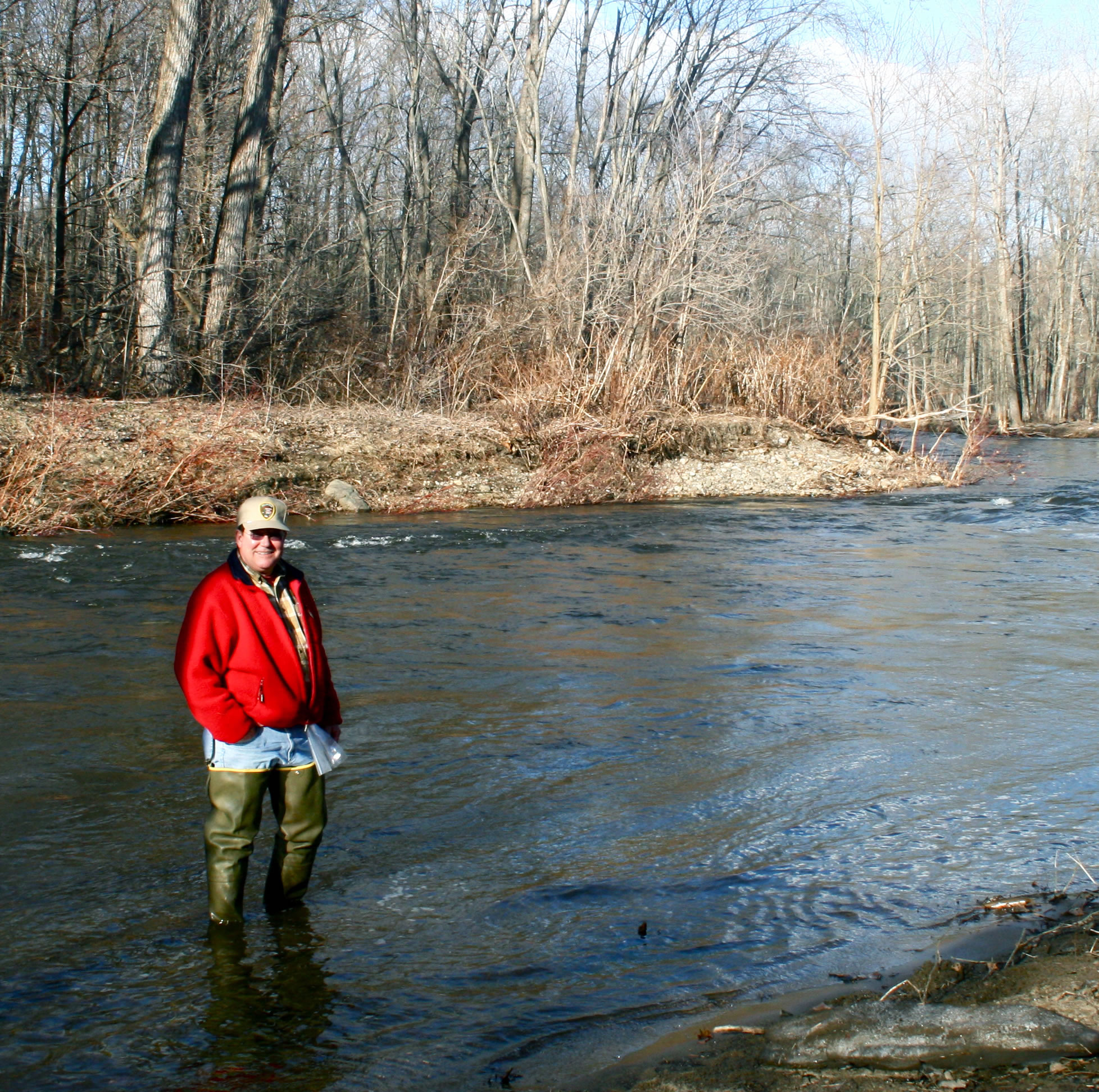
 A Statistical Analysis Comparing Water Chemistry Parameters in the Kayaderosseras
Creek Watershed with Land Use Patterns
A Statistical Analysis Comparing Water Chemistry Parameters in the Kayaderosseras
Creek Watershed with Land Use Patterns
Daniel de la Puente Ranea, Visiting Graduate Student; Catherine Berheide, Professor of Sociology; and Judith Halstead, Professor of Chemistry
The relationships between land use patterns, geology and major solute concentrations in stream water were investigated for the Kayaderosseras Creek watershed (484 km2) in Saratoga County, NY. A statistical analysis of water parameters indicated that the eight sites can be divided into three distinct groups. One group consisted of tributaries that are farther upstream near the headwaters of the watershed and which had the lowest values for all parameters. A second group of streams had intermediate values and the third group of tributaries, further downstream and adjacent to highways and development, showed higher solute concentrations. Subwatersheds corresponding to each sampling site were delineated and land use patterns were determined for each of the eight subwatersheds using GIS. The chemistry of the tributaries within the study area was explained by the percentage of urban development present in the tributary subwatershed, whose influence on stream quality is postulated to occur in three different ways: a natural spring water contribution, a road salt contribution, and an urban runoff contribution. The urban run off contribution may be due to municipal sewage pipe leaks, septic system leaks, lawn fertilizers and other anthropogenic sources.
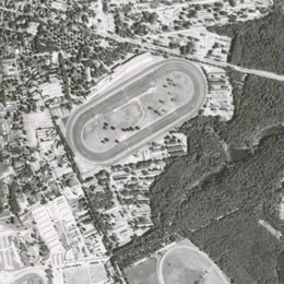
Joe Eisenberg '09 and Alex Chaucer, GIS Instructional Technologist
Aerial photography captures an important historic record of the surface of the earth at a specific date. This snapshot in time can yield valuable information about both physical and human geographic activity, which in turn can help to inform research in environmental studies, biology, history, sociology, economics, anthropology, and other disciplines. This project took a collection of over one thousand historic aerial photos from Saratoga County Soil and Water, taken between 1942 and 1986, and developed a digital system of access for local watershed research projects.
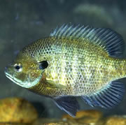 Impacts of Turbidity on Fish Foraging Efficiencies
Peter Liepzig-Scott '09 and Karen Kellogg, Associate Professor of Environmental Studies
Many human activities (e.g., agriculture, dredging, deforestation, construction, etc.) increase the suspended matter in surface waters (turbidity) and reduce water clarity. Despite the fact that increasing turbidity is one of the most pressing issues for fresh- and saltwater fish communities worldwide, the study of the impacts of turbidity has been largely oversimplified to include only mortality levels. In this study, we examined the foraging efficiencies of two visually orienting fish species, Etheostoma olmstedi (tessellated darter) and Lepomis macrochirus (bluegill sunfish), under varying turbidity regimes. Bluegills inhabit the water column in surface waters, and we found that these fish forage less efficiently at very low and very high turbidity levels. Tessellated darters are benthic dwellers, and we found that their foraging efficiency is consistent across turbidity levels.
 Landscape Migration Dictates Species Migration
Claire Superak '11 and Josh Ness, Assistant Professor of Biology and Environmental Studies
In terrestrial systems, landscape history influences susceptibility to invasion by nonnative species. We tested the hypothesis that riparian invasions of Japanese knotweed (Fallopia japonica) are disproportionately common and severe in portions of the Upper Hudson watershed where channel migration has occurred in last half century. We used USGS topographic maps to identify areas where new riparian habitat has been created in the Kayaderosseras and Battenkill river systems. Knotweed has colonized all disturbed sites, and the proportion of the newly created habitat that was invaded increased with the extent of the channel migration. Invasions in undisturbed sites were more rare. The histories of channel migration can indicate availability of susceptible habitat for invasion by Japanese knotweed and potentially other invasive species.